Travel & outdoors
Trekking community website
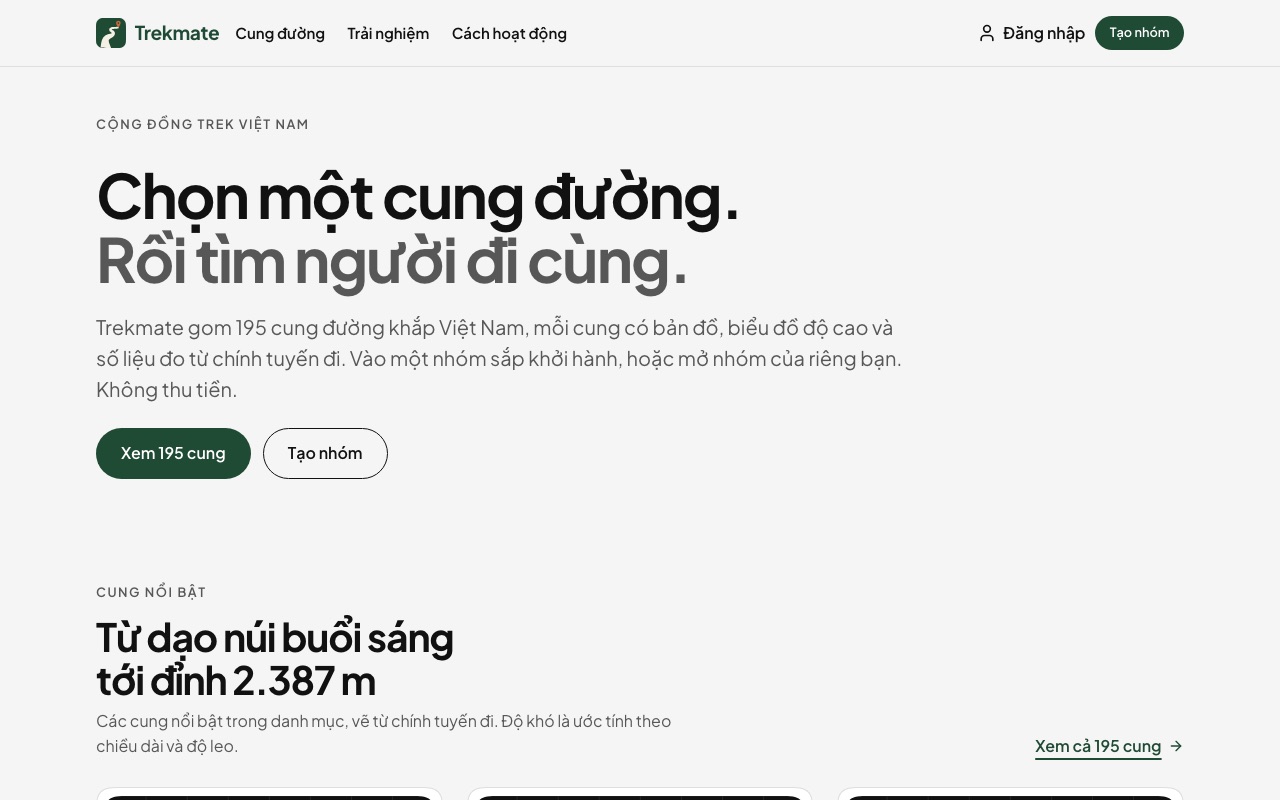
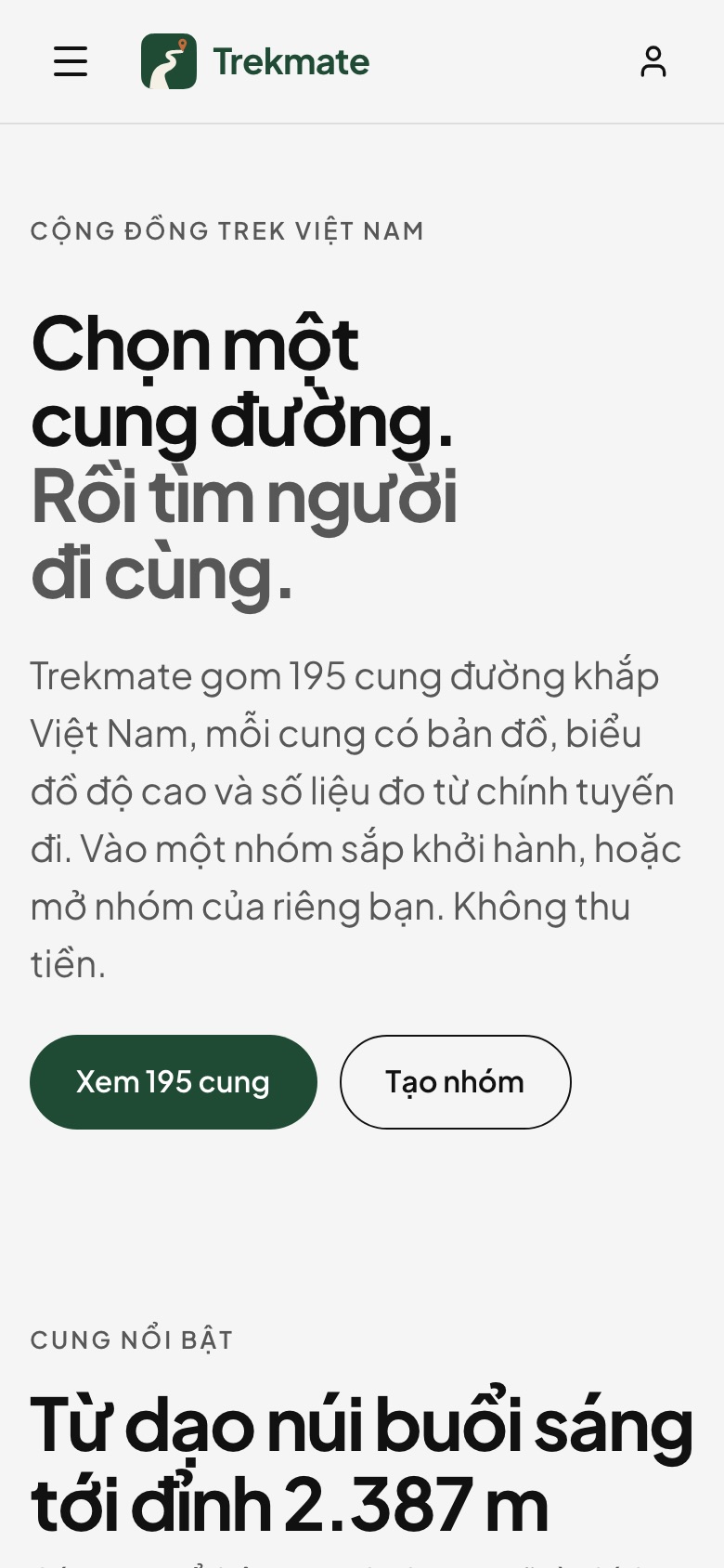
A trekking community needs two things: a catalogue clear enough to choose from, and people to go with. This template builds the catalogue first — 195 trails in 24 provinces, each with an SVG map, an elevation profile and seven figures, searchable without accents — then the groups: demo login, create a group, join, save and comment. The community part is a simulation kept in the browser, with no backend yet.
Great for: trekking, hiking and mountaineering clubs, outdoor travel groups, and anyone who wants a trail catalogue with groups to go together
Try the editor →Edit the content as the site owner would, no sign-in needed; changes are not saved.
Trekking community website
Overview
A trail catalogue you can filter, searchable without accents
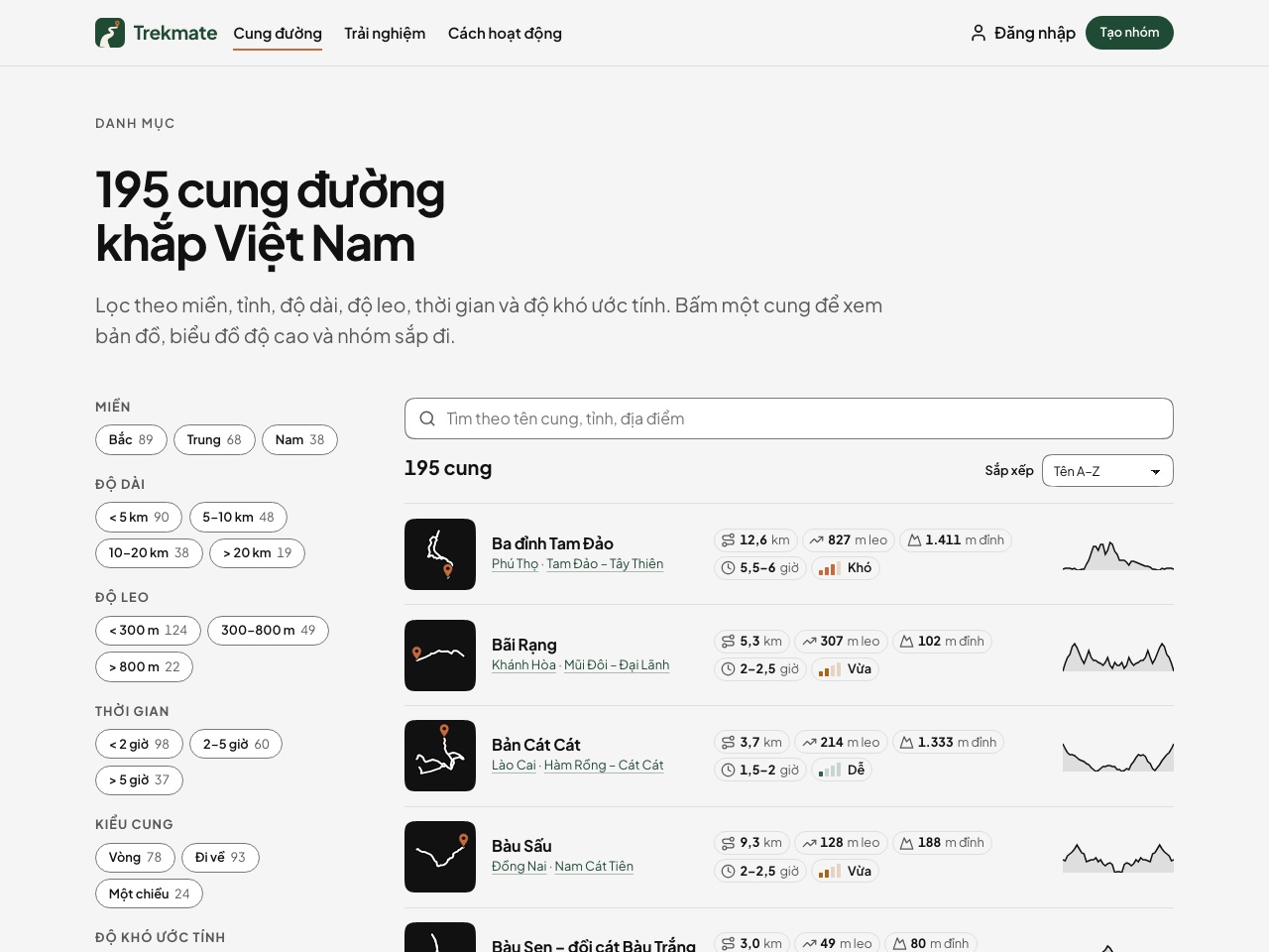
The Trails page lists all 195 trails by name. Filters for region, province, length, climb, time, route type (loop, out and back, point to point) and estimated difficulty each show a count; search by trail, province or place name works without Vietnamese accents; sort by name, shortest, most climb or highest. Every row has a route tile, five figure chips and an elevation strip. With JavaScript off the page still holds all 195 links.
A page per trail, its map drawn at build time
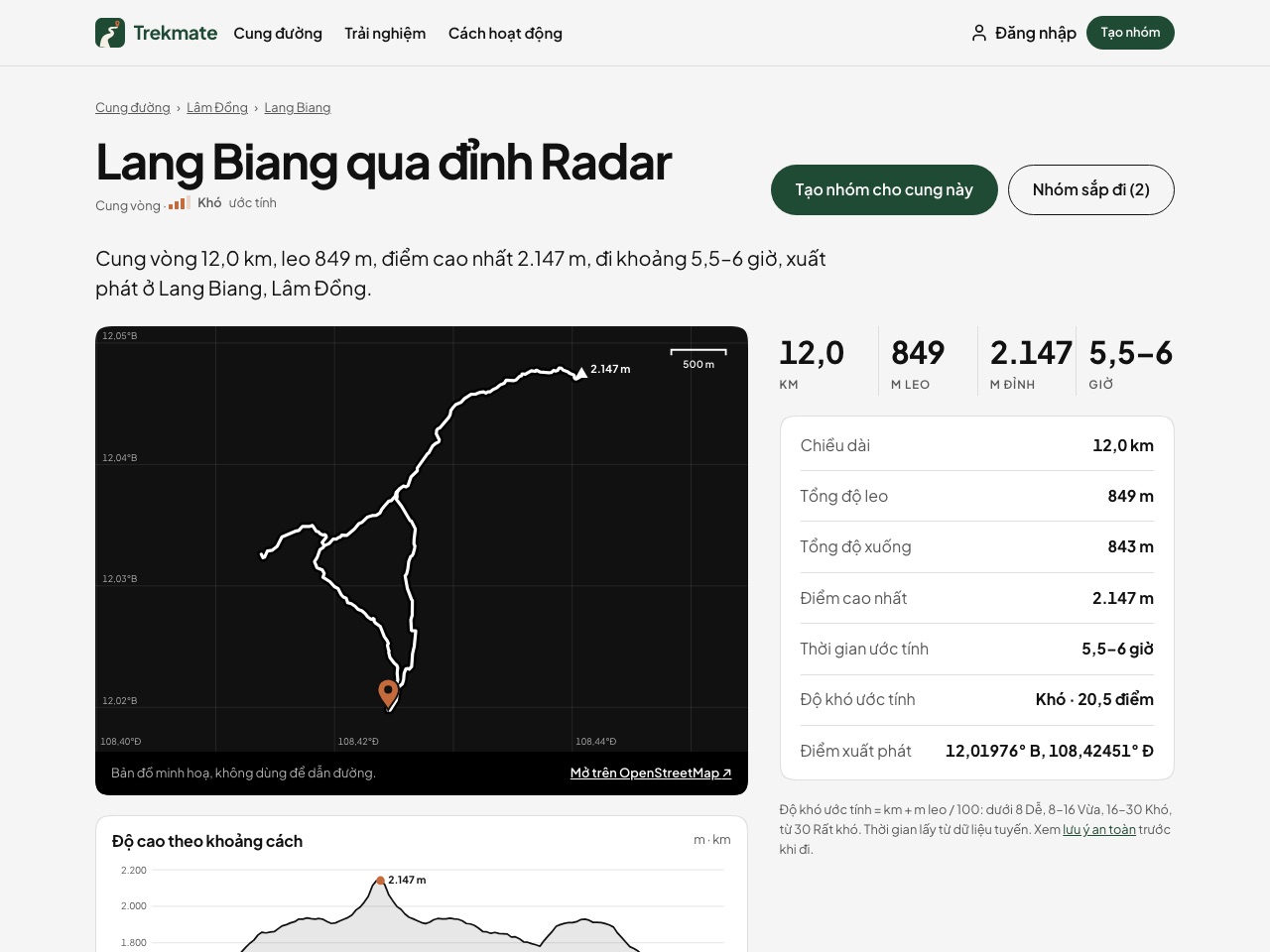
The map and the elevation profile are SVG drawn from the track itself at build time, with no map library to load: a coordinate grid, a scale bar, the trailhead pin, the highest point. Beside them sit a table of seven figures (length, total climb, total descent, highest point, time, estimated difficulty, trailhead coordinates), a link to the trailhead on OpenStreetMap, the groups about to walk the trail and the four nearest trails. Every map says it is an illustration, not for navigation.
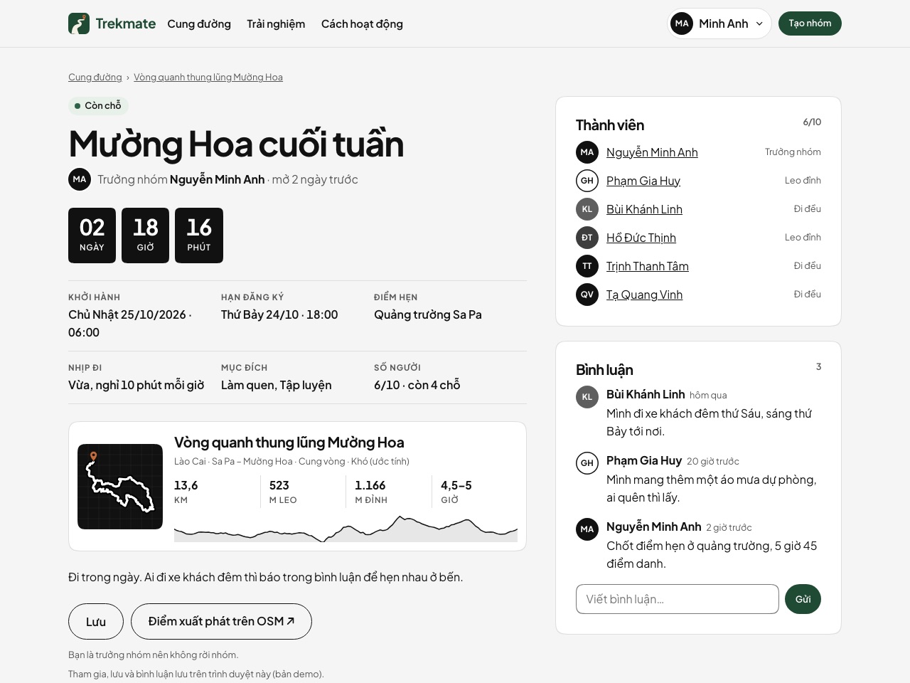
Groups to go together, to try right in the browser
Log in as one of 20 fictional members, open a group for a trail (date and time, maximum size, sign-up deadline, pace, meeting point) with a live preview card, then join, leave and save groups, comment and read notifications on the My page. A group's status has a shape as well as a colour: seats left, nearly full, full, closed, departed. Everything is kept in the visitor's browser: it is a simulation, with no backend or real accounts yet.
What's included
Trail catalogue
- 195 sample trails in 24 provinces and cities, grouped into 79 places, 1,742 km in all; each trail is an entry in the admin (name, summary, province, place, featured)
- The list filters by region, province, length, climb, time, route type and difficulty; search without accents; four sort orders; on a phone the filters fold behind a button
- Difficulty estimated from km and metres climbed, shown as four bars with a label; loop, out and back or point to point worked out from the track
- The 195 trails are sample data for the demo; tracks and elevation come in through the template's import script, not the admin
Trail, province and place pages
- 195 trail pages: SVG map and elevation profile drawn at build time, seven figures, a summary written from the figures, an OpenStreetMap link, the four nearest trails
- 24 province pages and 79 place pages: a map of every trail sticks in the right column, and hovering a row zooms the map to that trail
- Breadcrumb Trails › province › place on every trail page; a create-group button that fills in the trail
- Every map says "illustrative map, not for navigation"; the safety page gives only the national emergency numbers
Community (simulated)
- Demo login as one of 20 fictional members; 20 sample groups, each with a page, a countdown, members and comments
- Create a group in four steps: trail, date and size, pace and purpose, meeting point; a preview card and an error under each field
- My page: groups created, joined and saved, and notifications; 20 member pages
- Kept in the visitor's browser, so nobody else sees it; no backend, real accounts or payments yet
Pages and content
- Home page: 6 featured trails, trail counts by province and region, upcoming groups, four steps, experiences, an invitation to start a group
- How it works (four steps, 6 questions and answers), Trekking safety, Experiences
- A blog with 3 sample posts in 2 categories; each post points to trails in the catalogue
- Nothing for sale, no prices; no phone, email or social links published
Language, SEO and admin
- Vietnamese only; the Tina admin in Vietnamese
- A title and description of its own for every trail, province, place, group and member page; a 1200×630 share image
- The demo is hidden from search engines (noindex, robots.txt blocks everything); one switch in the admin opens it again
- Content edited in the Tina admin with a preview that follows as you type; five layout pages apply to every trail, place, province, group and member page
Pages in this template
Home
A text hero, 6 featured trails, trail counts by province and region, 3 upcoming groups, four steps, experiences and an invitation to start a group.
View on the demo ↗ (opens in a new tab)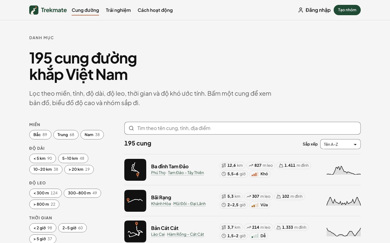
Trails
All 195 trails by name, filtered by region, province, length, climb, time, route type and difficulty, searchable without accents, in four sort orders.
View on the demo ↗ (opens in a new tab)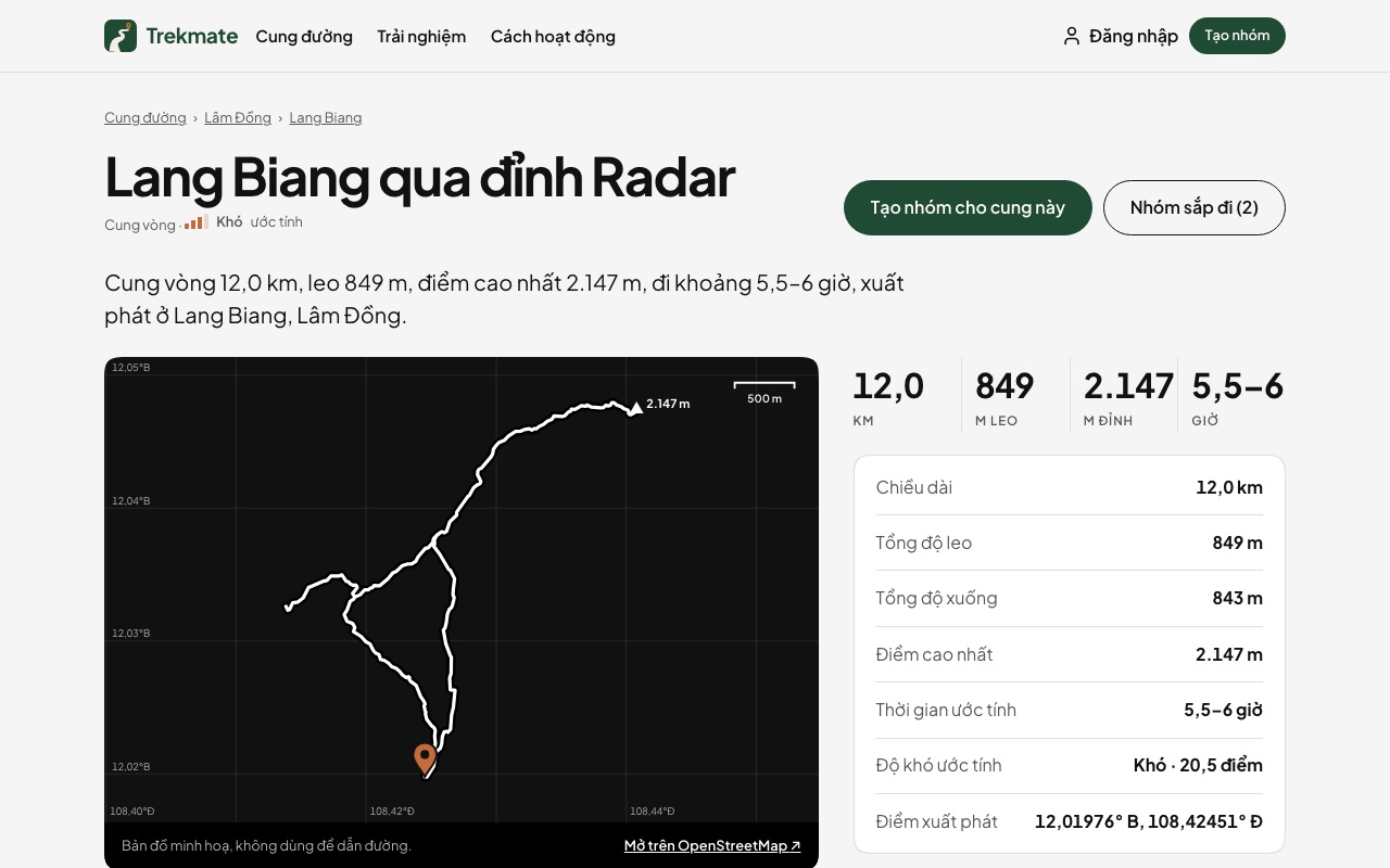
Trail page
195 pages: map and elevation profile, seven figures, estimated difficulty, an OpenStreetMap link, upcoming groups, a create-group button and the four nearest trails.
View on the demo ↗ (opens in a new tab)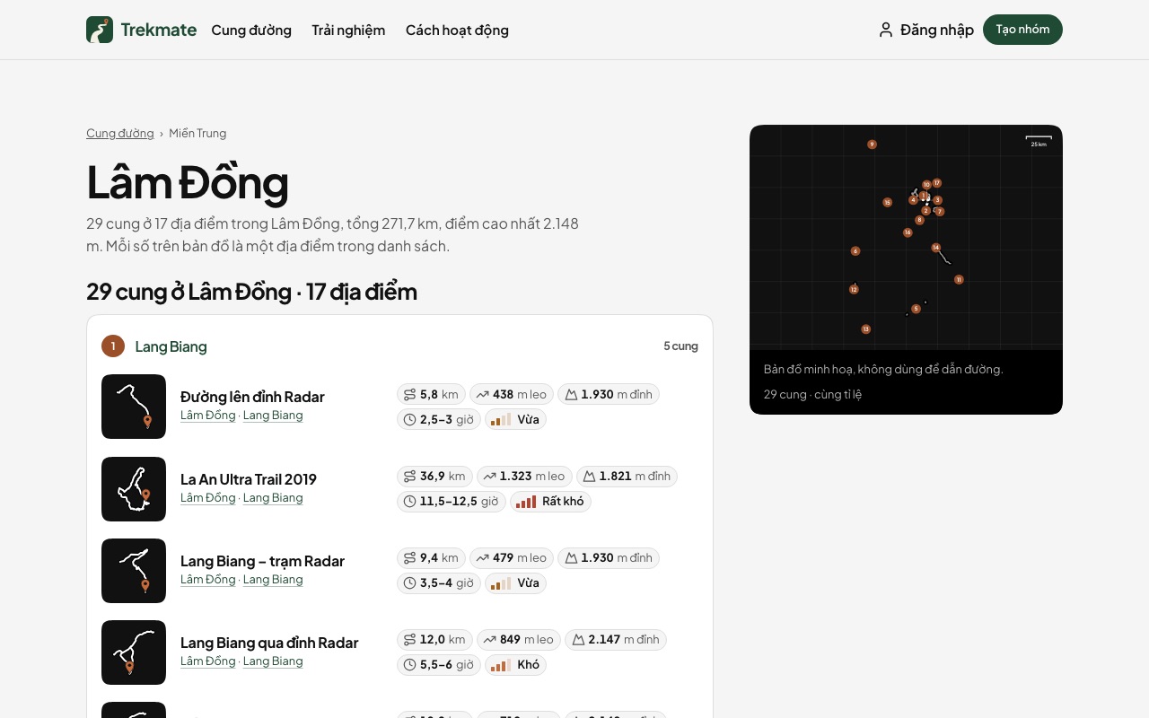
Province page
24 pages: a map of every trail in the province, its places in boxes with their trails A–Z, the map zooming to the hovered trail, upcoming groups in the province.
View on the demo ↗ (opens in a new tab)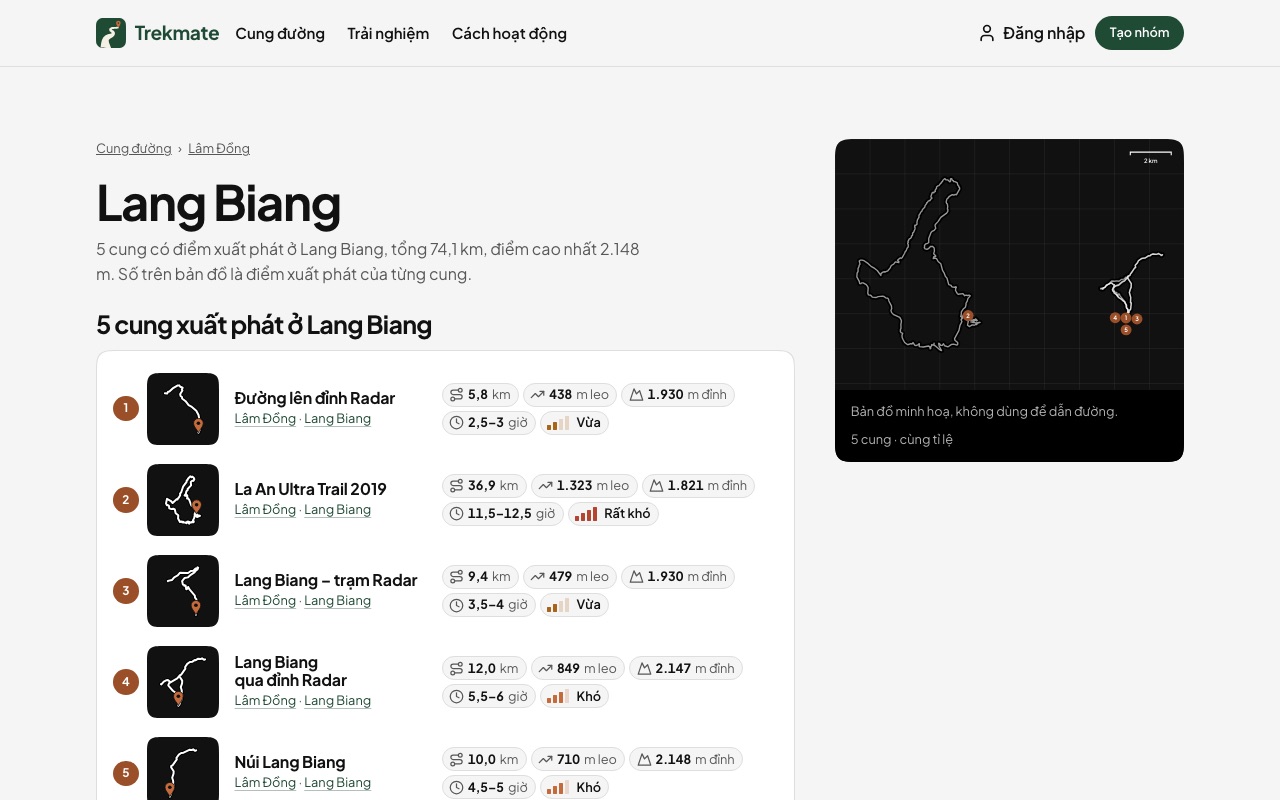
Place page
79 pages: the trails starting at the place, each row's number matching its trailhead on the map that sticks in the right column.
View on the demo ↗ (opens in a new tab)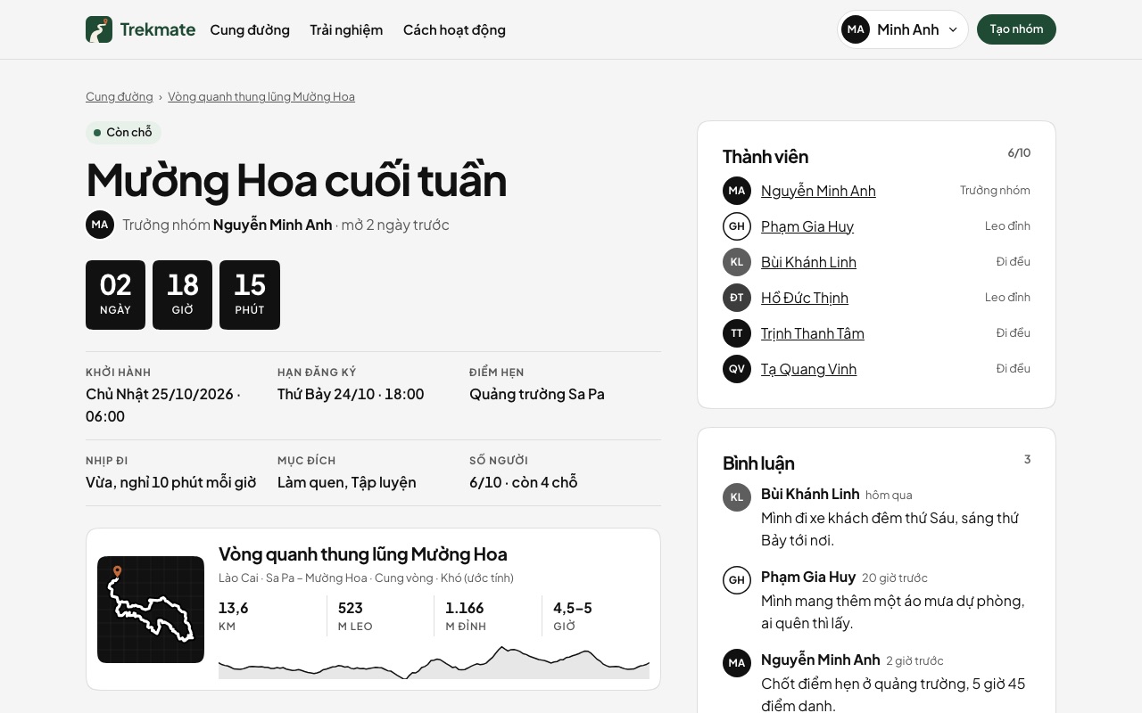
Group page
20 sample groups: status, countdown, departure, sign-up deadline, meeting point, pace, the trail, members, join, leave, save and comments.
View on the demo ↗ (opens in a new tab)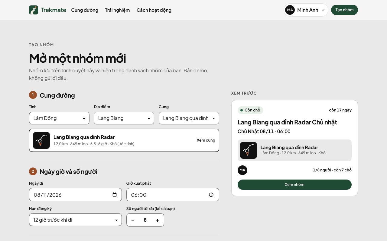
Create a group
A four-step form: trail, date and size, pace and purpose, meeting point and note; a preview card that follows every field; needs the demo login.
View on the demo ↗ (opens in a new tab)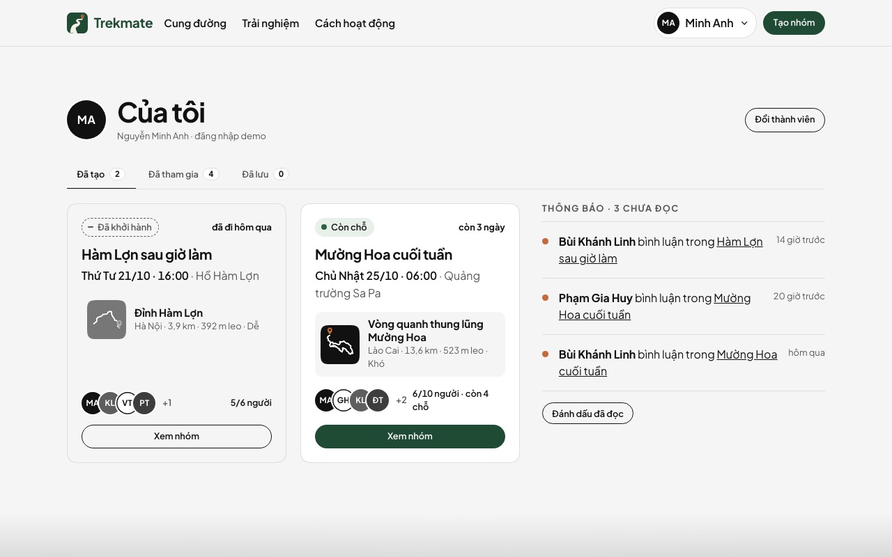
My page
After the demo login: tabs for groups created, joined and saved, and notifications with unread dots.
View on the demo ↗ (opens in a new tab)Demo login
Pick one of 20 fictional members, with a notice that says it is a simulation.
View on the demo ↗ (opens in a new tab)Members
20 fictional members, each with a page showing where they live, their level, their figures and their groups.
View on the demo ↗ (opens in a new tab)Experiences
Members' experience cards with a like button and links to blog posts.
View on the demo ↗ (opens in a new tab)How it works
Four steps from the catalogue to the meeting point, 6 questions and answers and an invitation to start a group.
View on the demo ↗ (opens in a new tab)Trekking safety
General advice before and during a trek, for long and overnight trails; the national emergency numbers.
View on the demo ↗ (opens in a new tab)Blog
3 sample posts in 2 categories, each with a block of the trails it mentions.
View on the demo ↗ (opens in a new tab)
More templates
Travel & outdoors
Trekking community website – map-paper edition
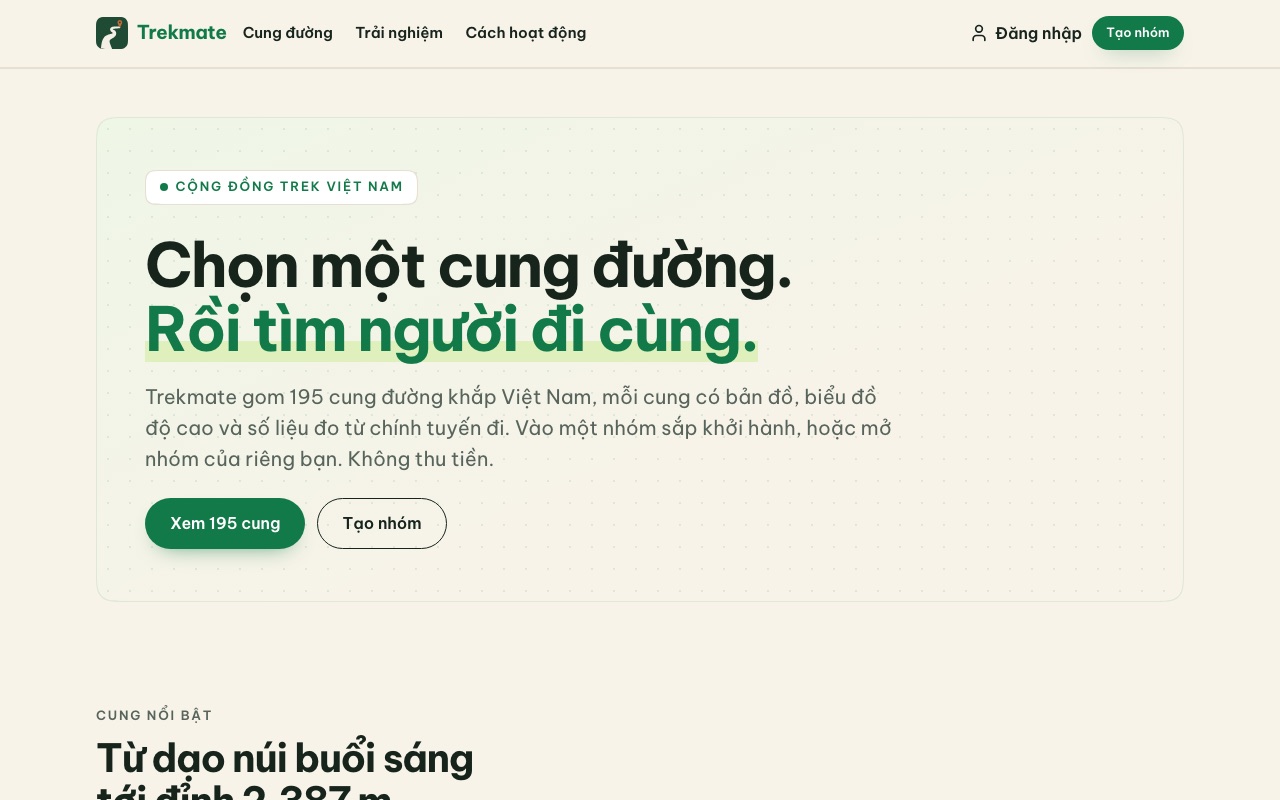
A second edition of the Trekmate template: the same 195 sample trails, filters, province and place pages and simulated community, in a bright "map paper" look — cream, forest green, paper route tiles, a static header and a colour footer photo. The demo is in Vietnamese only.
- ✓ 195 sample trails with maps and elevation
- ✓ Bright map-paper look in forest green
- ✓ Filter trails, browse province and place pages
- ✓ Group matching simulated in the browser
Automotive
Electric scooter shop
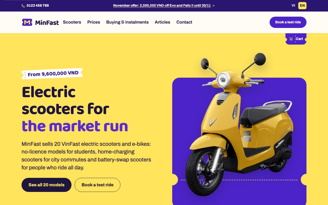
People buying an electric scooter ask three things first: how much, how far, and whether they need a licence. This template sorts 20 models into four groups by how people ride each day, gives each scooter a page with colour dots that swap the photo and a specifications table, shows both the with-batteries and the battery-rental price, and takes orders through a cart and test-ride bookings.
- ✓ 20 models in 4 groups, a cart that orders by phone
- ✓ Pick a colour and the photo changes
- ✓ With-batteries and rental prices, test-ride booking
- ✓ Vietnamese and English
Automotive
Light EV showroom
Many car buyers start with "what can I get for this much". This template puts a finder in the hero that takes a segment and a budget, opens the Models page already filtered, and draws the range per charge as battery cells that are easy to compare.
- ✓ Find a car by segment and budget
- ✓ Battery cells for the range per charge
- ✓ A configurator that fills in the deposit form
- ✓ Vietnamese and English

Our promise
-
Docs written for AI
Every template comes with a workflow and docs an AI agent reads before it edits the source code for you.
-
Host it yourself, or we host it
Follow the deployment guide in the docs, or use our hosting.
-
Edit it yourself
Click any text or photo on the page to change it. No code needed.